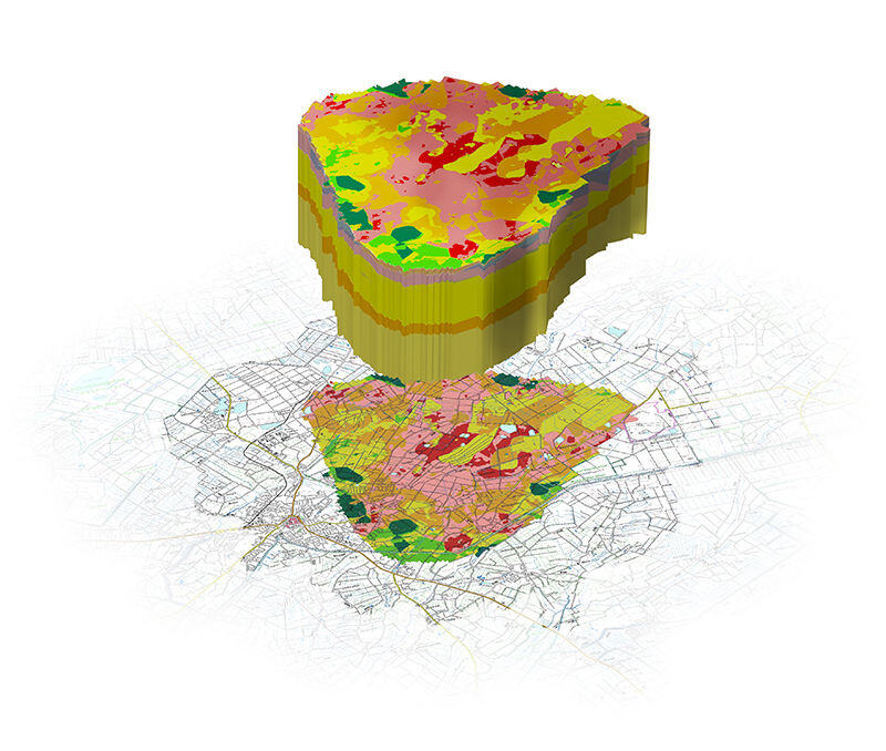
Explore the full potential of your geodata
Take your projects to the next level with 3D modelling of the subsurface.
Digitise the ground beneath our feet and gain clarity about geological processes at depth.
What is the SubsurfaceViewer?
The SubsurfaceViewer offers you innovative technologies to take a look beneath the surface. Whether you are a municipality, a water supplier, disaster control or an industry - our versatile tool enables you to carry out accurate analyses and precise visualisations. SubsurfaceViewer puts you in control of the invisible.

Functions of the SubsurfaceViewer
Our SubsurfaceViewer offers you powerful functions that provide you with valuable insights. With interactive 3D maps, you can explore the depths in more detail than ever before. Real-time monitoring and analysis allows you to make faster, more informed decisions. Visualise complex data in vivid graphics and gain a comprehensive understanding of the subsurface environments you work with.
Application areas of the SubsurfaceViewer
The SubsurfaceViewer offers customised solutions for various application scenarios. In raw materials extraction, it enables efficient exploration and resource management. In water and wastewater management, you can optimise your supply systems for sustainable use. In disaster prevention, you can recognise hazardous situations proactively and respond to them quickly. The SubsurfaceViewer also supports the planning and monitoring of infrastructure projects in industry.
Why choose the SubsurfaceViewer?
Compared to conventional methods, the SubsurfaceViewer offers clear advantages. Thanks to precise visualisation and analysis, you can optimise your processes and save time and money. We also offer customised solutions that are specifically tailored to your requirements. Put your trust in our many years of experience and expertise in the subsurface sector and make well-founded decisions with SubsurfaceViewer.

The SubsurfaceViewer supports you in the creation of geological models
Developed by geologists for geologists. Create regional models, analyse geodata and shed light on the subsurface.
Conceptual geological structure models
- Simple integration and visualisation of field data (boreholes, borehole geophysics, other measurement data) in 2D, 3D and profile sections
- Simple integration of geological maps
- Simple integration of digital terrain models
- Rapid construction of aligned profile section networks
- Construction of structural models using structural maps (isolines/isopachs)
- Synchronised views of data and constructions between 2D, 3D and profile section viewers
Geological parameter models
- Simple conversion of structural models into voxel models
- Simple workflows for layer-internal interpolations using inverse distance weighting (2D, 3D) or Voronoi diagrams (2D, 3D) as well as ordinary kriging and indicator kriging
- Extensive filter functions (project geometries and data), clipping, exports, interface extractions
- Parameter calculator for voxel and grid models
- Descriptive statistical analysis of selected voxel content
- Profile type maps with interactive visualisation, created from structure and parameter models with and without conditions
Analysis of digestion data
- 2D, 3D and profile section visualisation, optionally as downhole curves of georeferenced point data sets
- Table intersections for georeferenced borehole and point data sets (measurements, interpretations, etc.)
- Extensive filter functions (project geometries and data), extractions of filtered and intersected tables, exports
- Descriptive statistical analysis of selected georeferenced point data
- Correlation analyses (Pearson, Spearman, pairwise)
- Built-in functions for data transformations (e.g. z-score, log-ratio, binary encoding, label encoding, principal component analysis)
Labelling of geological point and drilling data sets
- Simple labelling tool with ad hoc visualisations for location groups and layer assignments in 2D, 3D and profile sections
- Simple georeferencing tool for drill core or outcrop photography and integration into the visualisation of downhole measurement data
- Built-in interface for Kmeans clustering and classification using the Gaussian Mixture Model with analysis function for determining cluster numbers (Python)
- Built-in interface for random forest and XGBoost classification (Python)
- Exports the labelling to simple tables for further use
Lithological analysis
- A continuously evolving translator of descriptive drilling data into inferred grain size distributions, mineral and organic components, sub-units and more with customisable dictionary
- Calculation of lithological downhole curves for coarseness, degree and type of mixing for comparison with other measured data
- Visualisation of lithology, also optionally from sieve grain analyses in the ternary diagram
- Simple tool for manual classification of lithologies based on interaction in the ternary diagram or input and export of the classification
- Sampling of possible kf value distributions based on lithologies (from parser or sieve grain analyses)
Spatial multi-criteria analysis (SMCA)
- Simple structure of a decision process with metadata input, geofactor selection, objective function determination and weighting
- Weighting using either Analytical Hierarchy Process or Simple Linear Weighting with intuitively understandable visualisation
- Offsetting as Simple Linear Offsetting, Highest Value or Lowest Value and Gap Filling with output as 2D raster data.
- Comparison tool between different results of decision processes
- Restriction of decision processes to area boundaries
- Transformation tool for polygon shapes in geofactors
- Raster adjustment for rasters with outliers as index raster or continuous raster data
Quick decisions with the SubsurfaceViewer!
Optimise your processes with our SubsurfaceViewer! From raw material extraction to disaster prevention - we offer customised solutions for your needs.
Find out more about our powerful functions and contact us today!